
Outline Planner
Outline Planner has all the features of Planner Plus but uses the Neptune outline charts. It was designed for customers who already have a plotter and want the tidal course calculations from tides, streams and wind.
It offers course calculations from inbuilt tidal height, tidal stream and wind routines, producing course to steer, course over ground and optimised departure. GPS track plot, AIS, waypoint manager, GRIB files, Google Earth, course over ground animation, SOLAS compatibility and polar plots are all included, and it incorporates the Neptune tidal heights program.
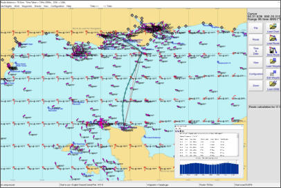
After a calculation the results are on screen with the vector plot construction shown, so you can cross check your chartwork.
Windows may warn you, or look as though it has blocked the file, before it will let the installer run. That is because our installers are not code signed, not because there is anything wrong with them. Choose Keep, then More info and Run anyway. Step by step, with screenshots.
Prices
| Item | Price |
|---|---|
| Neptune Outline Planner program | £50.00 |
| Outline chart portfolio, each. At least one is needed | £19.00 |
System requirements
Windows 8, 10 or 11. Processor speed 1.6 GHz, 2 Gb RAM, typical hard disk space 300 Mb.
New in version 11.1.5
- Automatic chart change using the mouse scroll wheel
- Waypoint and route management using the modern GPX format, for example Garmin or OpenCPN
- Waypoints and routes compatible with the Neptune app
- UK wrecks and obstructions with details of depths, history and cargo
- Touch screen or mouse input, new menu layout, easier chart selection
Program features
- Course to steer calculations
- Route optimised departure
- Course over ground
- Dynamic tidal stream
- Wind and polar plot
- Animate routes
- Tide and water track roll
- Track plotter
- Waypoint editor
- SOLAS compatibility
- Course and tidal vectors
- Cross track error displayed
- Interfaces to GPS
- Interfaces to AIS engine
- Tidal stream reports and graphs
- Incorporates the Tides program
- Range circles
- Configurable displays
- Data derived from UKHO sources
- GRIB files for internet weather
- Google Earth course over ground and tracks
- Select charts using thumbnails
- Zoom to rectangle
- Copy screen and route buttons
- Snap to waypoints
- GPX for waypoints and routes
- Waypoint transfer to GPS receivers and plotters via NMEA 0183
- AIS aid to navigation beacons
- UK wrecks data